A Look at Winter 1 year ago
August 25, 2024
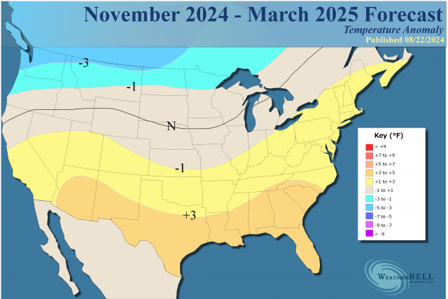
- Warmer than normal in the East and the South is expected for the Winter Season overall.
- However, a cold Canada will set the stage for impactful cold air outbreaks.
- Rapid cooling of oceans may throw a monkey wrench into things.
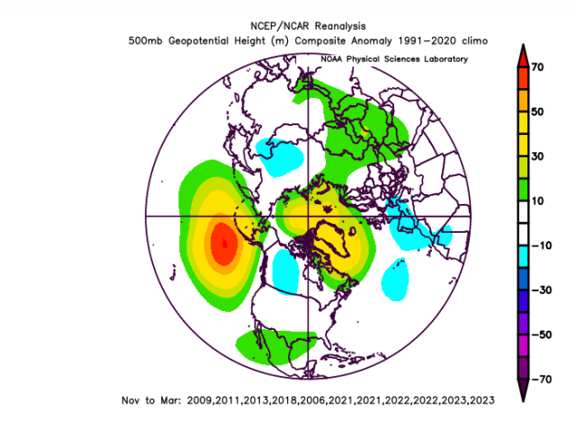
- The pattern over North America should be in line with recent high-impact hurricane seasons and cold PDO analogs.
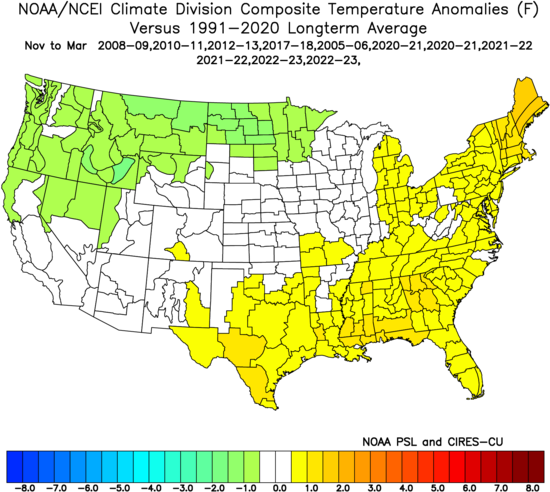
Temperature analog:
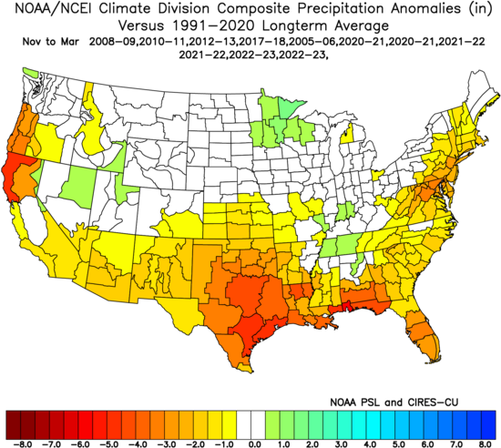
Precipitation analog:
My last two winters have been disasters in my opinion and likely yours too. Both times the MJO really kept the cold at bay. Both times the cold came and as it came, it went. Both times there were severe arctic attacks for 2-3 weeks into the Heartland, but since the N-M period is 20 weeks, it doesn't take a weatherman to know which way that wind blows.
2021-22 was a very good winter forecast for me. It was very odd, because that was the most distracting winter of my life. My mom and dad got Covid and died, and it was so weird that it seemed like it made me focus more on things that turned out right. I have to confess this. I think a lot of the times I was right at Accuweather with the lack of data was like, there was something bigger than me at work. I know that is not scientific, but somehow when things were toughest, it was like the answers were more clear. I will leave it there, but I have always said what I believed and wore my heart on my sleeve.
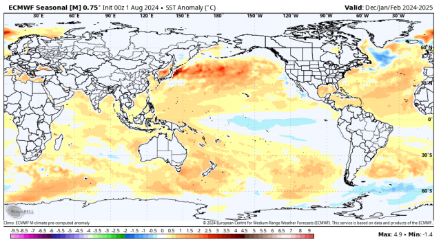
In any case, the Euro's SST forecast suggests a cold PDO with a weak La Niña and warm water around Australia, which we saw last year kick the daylights out of the cold after the January outbreak. The Kuroshio current continues to run rampant in the North Pacific, which means a cold PDO look. Between the release of heat from enhanced precipitation over Southeast Asia and the warmth of the North Pacific, it looks a lot like the snowless winter in the East from two years ago.
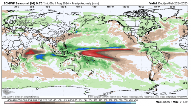
The Euro's forecast is surrounding Australia and the response is clear in the precipitation pattern:
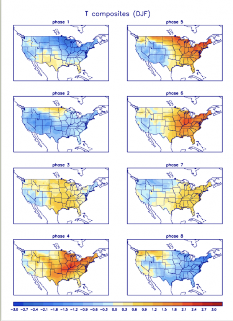
This looks like Phases 4 and 5 of the MJO dominating:
.gif)
This MJO pattern is the kiss of death for sustainable cold in the East, as we have seen over the last two winters.
The Euro's sea level pressure forecast:
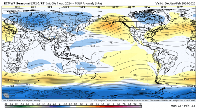
That looks like Phases 4 and 5, with high pressure near the East Coast, suggesting a southwesterly mean flow for the heart of the season.
.gif)
The temperatures for those phases:
The Euro's 500mb forecast:
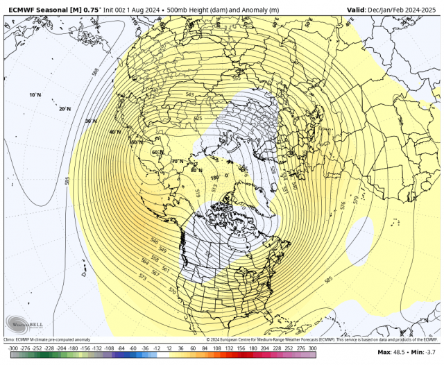
This would allow for a lot of cold air into Canada and perhaps the West and northern Plains. It would produce some blunted intrusions farther to the east and south.
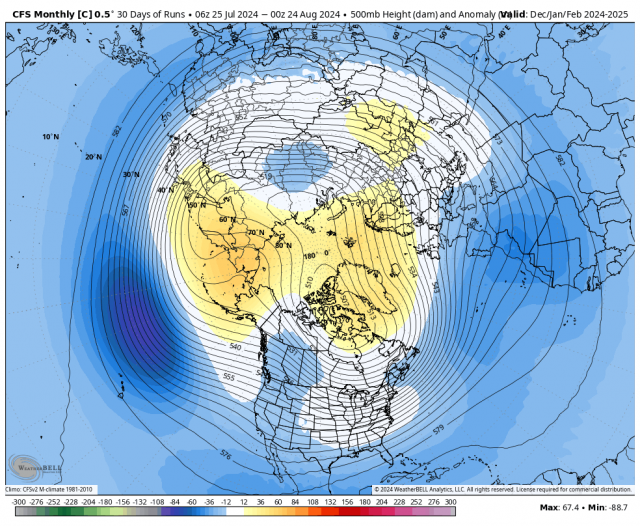
The 30-day runs of the CFSv2 Control are, as usual, colder:
The Canadian Seasonal:
.png)
The Euro temperature forecast:
.png)
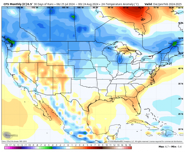
The CFSv2:
The Canadian Seasonal:
.png)
Those all suggest that Canada will be cold. Interestingly enough, the analog package I have does suggest enough blocking for cold intrusions, but remember the winter two years ago had blocking but the signals from warmth overwhelmed it.
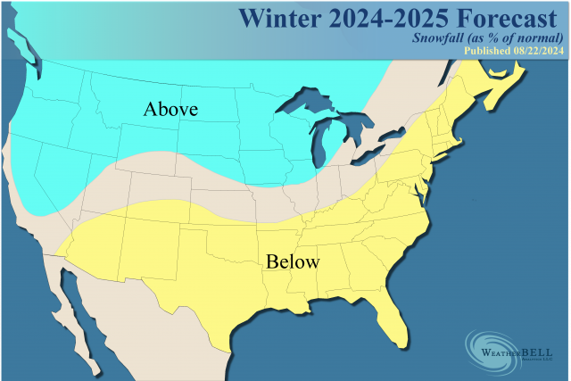
There should be a lot of precipitation in the Heartland, and it will be drier across the South. That implies a snowy winter in the West and northern Plains and there could be a 3-4 week period of snowiness in the East, too. I have a tough time envisioning the cold outdoing the warmth overall though.
It's interesting that if there is a high impact mid to late hurricane season that is coordinated with a fast start to winter in December. Remember winter disappeared two years ago after an early start, as it did last year after the January outbreak.
There are two wild cards here.
- The ocean is rapidly cooling. I have alluded to this happening on my Premium blogs since Spring. We are likely to see a big drop off in SSTs, but it's still warmer than average, so that may cause a different feedback from the change in temperatures. It seems like when the oceans are warmer, like they have been the past few years, you bet on warmth.
- We are seeing high solar activity. This is Joe D'Aleo's realm, and I am becoming more aware of it. The lack of hurricane activity this year, given the ideal SSTs in the Main Development Region, may be due to this high solar activity. That pattern is correlated with high solar activity. We also have some other things going on that are a product of the distorted warming, which is something I am more acquainted with.
I don't know if the cooling oceans will be a cattle prod. There is a drop-off in geothermal input so, though it lags a bit, it should cool.
What is the reaction to the cooling as inputs vary? I don't know. Remember, it's cooling, but it's still very warm.
Here is the solar cycle, and it is running over projections:
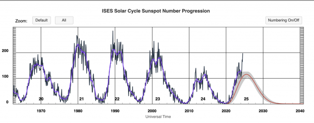
This is funky, as a drop off of the high solar activity, even at the peak, can have a cold winter within the overall warmth. If we look at the last peak in 2011-2012, they were very warm, along with 2015-16. It was cold late in 2012-13, 2013-14, and 2014-15. The four winters of 1998-99 through 2001-02 were warm, except for 2000-01 (though that mainly was early). Currently, it's crushing the forecast as you can see, but the question is will it drop off? Both geothermal and solar wild cards create an unforecastable situation at this lead time. I will need some additional time to make a more precise analysis.
The Verdict
Overall, we expect another winter season with warmer than normal temperatures in the East. With all of the potential for cold air in Canada, there is a threat of major intrusions for a few weeks at a time. Most of the very warm winters have cold intrusions, but the winter comes down to warmth outdoing cold, which is the message here for the East and South.
The opposite is likely for the West and North. Snowier than average conditions are expected over the Plains and Northwest, along with much of Western Canada. Snow is going to be a real roll of the dice for areas farther to the East, with less than average snow events (as far as an overall number), but one or two big storms can make up for it in amounts similar to 2021-22. Those one or two major events have been completely missing over the past two winters.