Northeastern Europe Heat 9 years ago
August 4, 2015
Heat To Build into Northeastern Europe
- So far, Europe's growing season has seen warmth dominate to the south, while it's been a back-and-forth pattern with mostly cooler than normal temperatures farther to the north.
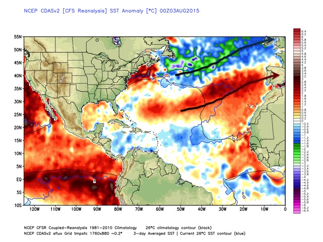
- Ocean temperatures with cold water in the North Atlantic and a strip of warmth to the south have helped create that contrast and oscillating boundary.
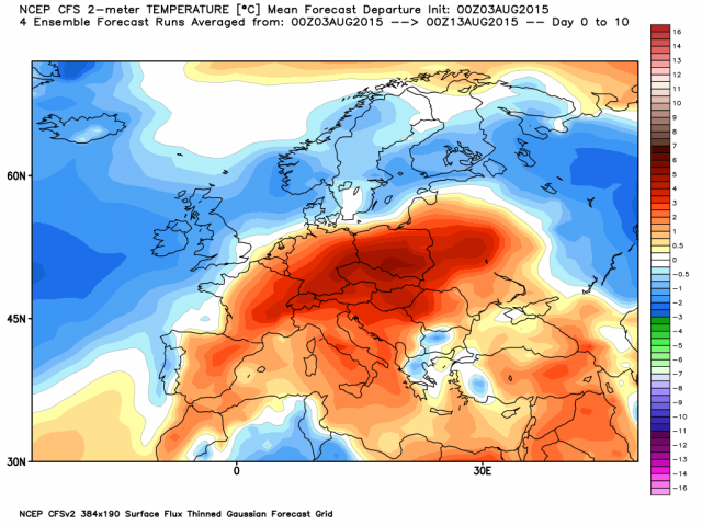
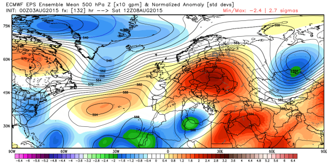
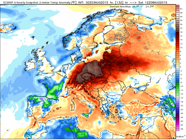
- After a cool down this past week, a strong warm surge into northeastern Europe (reaching Germany and Poland) will follow on Saturday.
- Dryness will continue along with the heat to stress reproductive corn across all but far northern areas.
- In some northern areas, it has been wet, which has benefited reproductive summer crops but has slowed harvest of winter crops.
As seen on the map below, the contrast of the cold water to the north and the band of warmth to the south enhances the jet stream in that contrast zone, moving storms inland. These carry cooler air to the north and pump warmer air to the south (from off the warmer water). The arrows show how the flow beneath the storm track comes in from the colder water to the north and the warmer than normal water to the south.
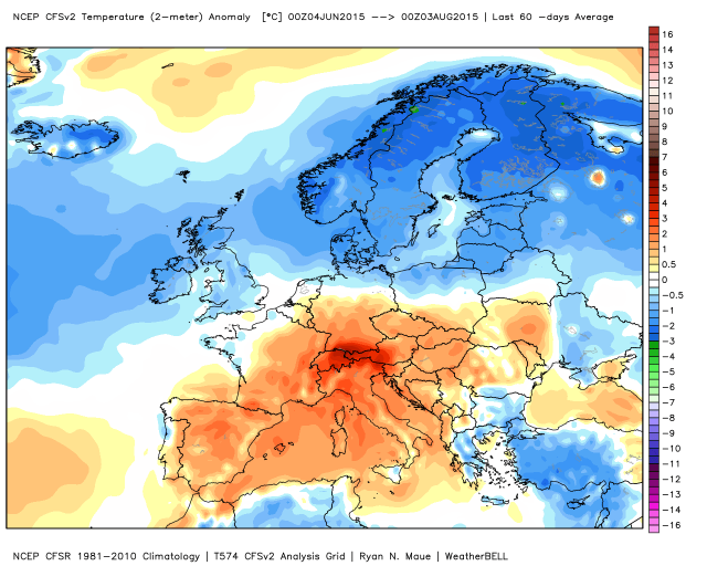
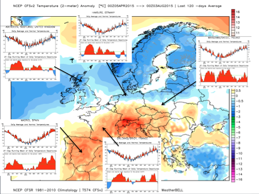
The average temperature anomalies over the last 60 days indicate that the dominant pattern has been chilly to the north and warmer to the south.
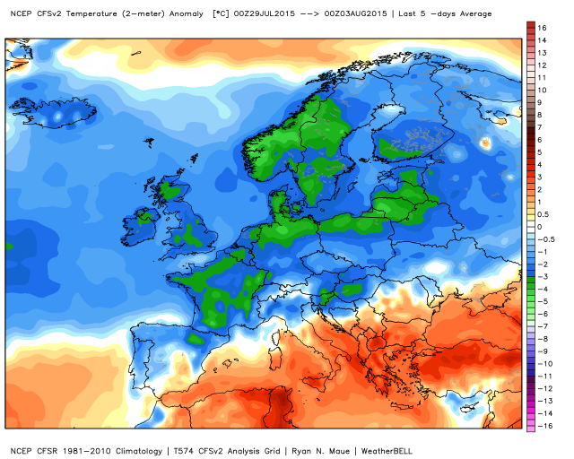
The boundary has settled to the south this last week, with a large cooler Atlantic air mass following on the heels of a storm tracking across northern Europe.
The next 10 days will see the warmth spread northward again ahead of the next storm.
Over the last 4 months, the North has seen ups and downs with some overall cooling while warmth has persisted to the southwest and northeast.
After the last cool down, the next week will see another surge of warmth pushing into the Northeast. The ridge in northeastern Europe will focus very high temperatures on Saturday into southeastern Germany and Poland.
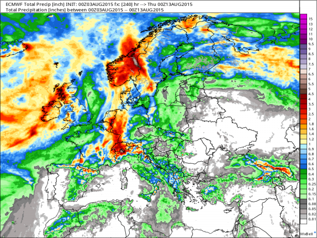
Although it has been wetter across the Northwest, northern Germany, the Netherlands and Scandinavia over the last 30 and 60 days, dryness has persisted in central France, southern Germany, in Poland and in southeastern Europe.
.png)
.png)
The annual precipitation (shown over the 120-day anomaly chart) shows that the dryness from France to Germany, in Poland and in southeastern Europe has been a long term trend.
.png)
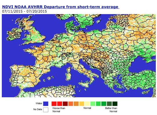
The following image shows the areas where vegetation has been most negatively affected (orange colors). Greener areas reflect the best vegetation health.
The next 10 days look to be wettest across western and central areas ahead of the next cool front (behind the warm surge). Note how dry it will be to the east.
Summary
Most of central and southern Europe has had a warmer and drier summer than in recent years in part due to temperatures in the Atlantic Ocean, which are cold to the north and warm to the south.
Another untimely surge of heat is forecasted following a cool week last week. This will further hurt yields of reproductive corn. The dryness will favor the drydown and harvest of winter grains.