Winter 2023-24 Preliminary Forecast 1 year ago
August 15, 2023
- El Niño is going to be a big influence this year.
- The type of El Niño will ultimately decide the pattern.
- The first part of winter may be mild
- The coldest and snowiest part of the winter should be from mid-January onward.
- Europe looks cold and wet also.
- HDD numbers will come out with the next forecast.
The temperature forecast:
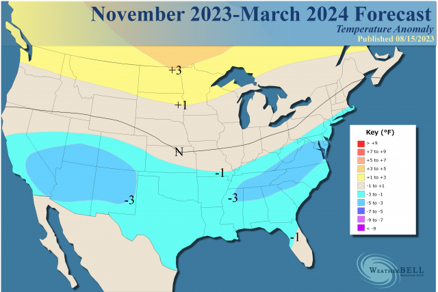
Snowfall:
.png)
At this time, the forecast is based on the oceanic conditions in Nino1+2, Nino3.4, the MEI, and the European/Canadian blend. The U.S. climate model has been all over the place. You can see the U.S. model swinging back and forth between jumping on the very warm El Niño winters as they are now, and the colder ones as they did before. If you make enough forecasts, one of them will be right. So for now, I will use the more consistent Euro and Canadian.
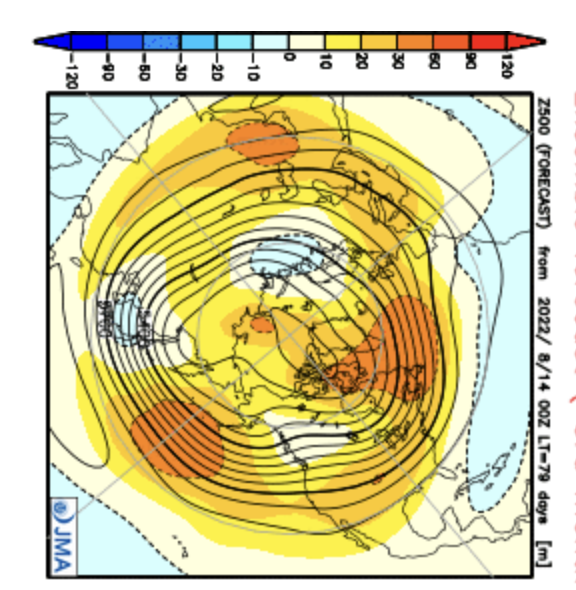
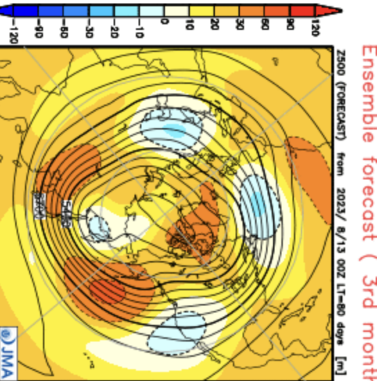
The JMA is only out to November but looks much different than last year already. Last year:
This year:
The Euro:
.png)
Canadian:
.png)
The JMA shares in common a November look of an evolving jet cutting underneath with blocking over the top.
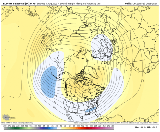
The December-February forecast from the Euro:
Canadian:
.png)
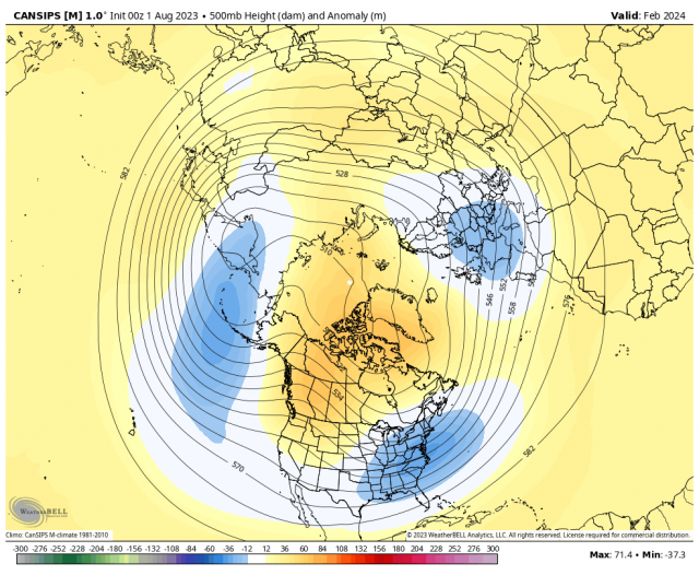
Both have February as the coldest of the three months in the heart of winter. February Euro forecast:
.png)
Canadian:
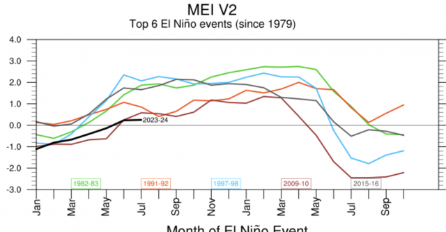
El Niño Analogs
The MEI is running closest to 1991-92. We are seeing a disconnect between the MEI, which incorporates atmospheric and radiation variables, and the ONI, which is only based on SSTs. The MEI's main contributors are 1991-92 and 2009-10:
Nino3.4:
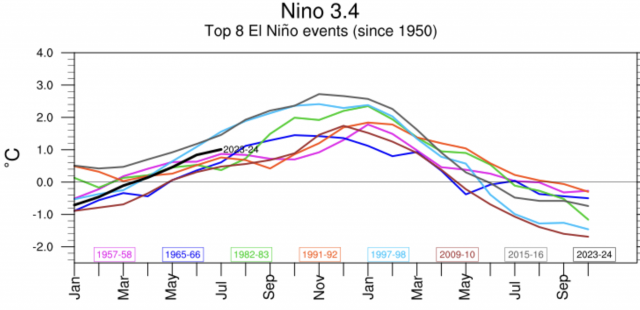
Nino3.4 finds us at the top of a cluster that includes 1957-58, 1965-66, 1982-83, 1991-92, and 2009-10. It is most likely to follow 1982-83 and 1965-66.
Nino 1+2 looks like a blend of the last two Super El Niños (1997-98 and 2015-16):
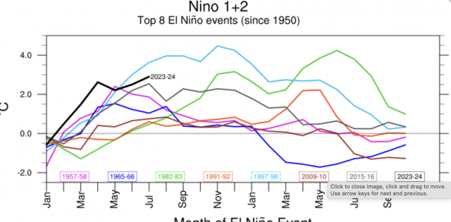
So what does this give us for weighted contributors? For the MEI it's 1991-92 and 2009-10. For Nino3.4, it's 1957-58, 1965-66, 1982-83, 1991-92, 2009-10, 1965-66, and 1982-83 double-weighted based on the SST forecasts. For Nino1+2, we are like 2015-16 and 1997-98.
This gives us a 500 mb analog pattern like this:
.png)
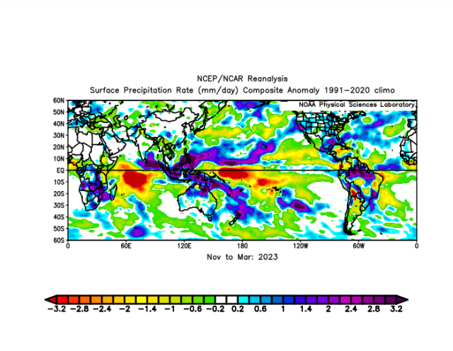
The associated precipitation pattern is pretty much the opposite of last year.
.png)
Last year:
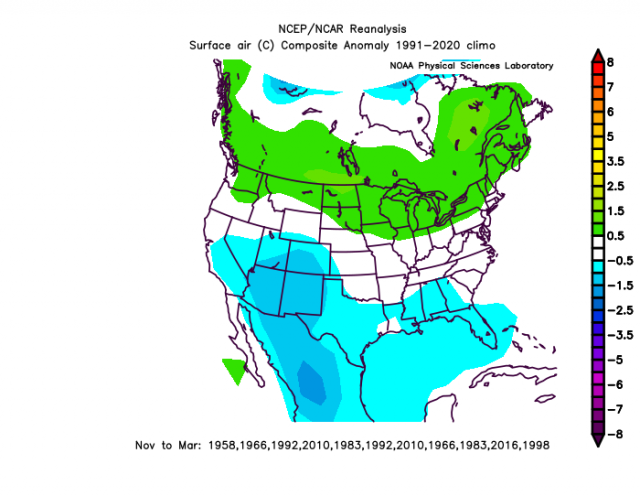
The analog gives us these winter temperatures:
The early winter analogs are warmer:
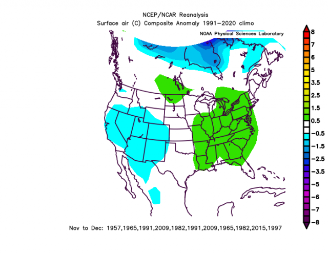
The late winter is colder:
.png)
However, there are some caveats here. For the sensible analog for November-March, I am keeping more weight on the migrating Mokodi-type El Niño. Some of the members are already there, but the only one that is not is 2002-03. So it means doubling up on weights:
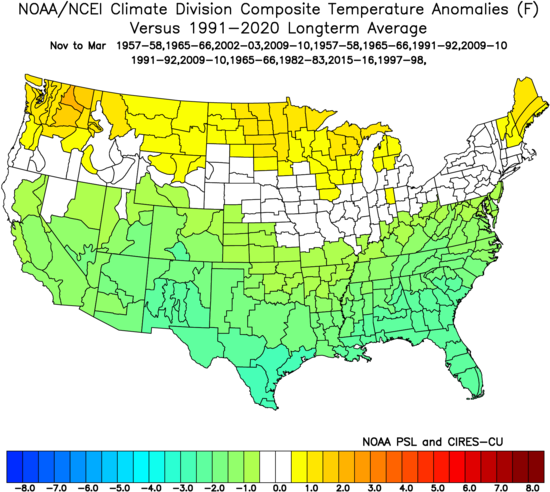
Precipitation:
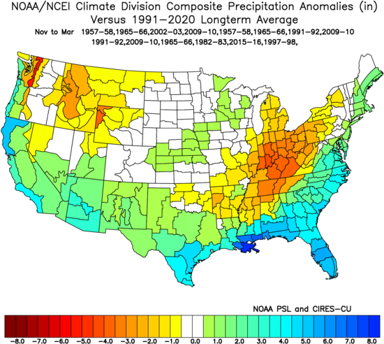
What is interesting is that sometimes even if something does not show up strongly in the analogs, when all the analogs are sorted out, another winter may look like it. The winter of 1986-87 comes to mind:
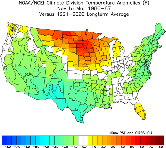
November and December were warm then. The ONI El Niño was moderate and the MEI reached moderate, too.
The Verdict
There is a lot of potential for this winter provided the El Niño weakens and moves into the central Pacific (Nino3.4). The MEI is certainly not in the same ballpark as the ONI and is heading to the weaker and more classic snowy, cold winters. I expect the opposite of last winter, when we came out of the gate fast and then fell apart. I can't rule out a 2009 December to remember, but the idea here is the core of the worst part of winter, relative to averages, should be from mid-January onward.